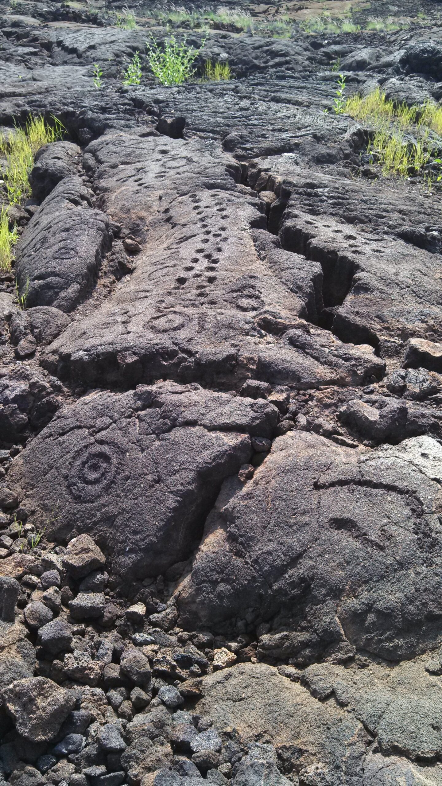
After the crush of summer tourism, we again returned to the Big Island of Hawaii to see how some of the archaeological sites withstood this year’s visitors. We observed several fish traps, some rock art and game boards, two ancient village areas, and a place where medicinal plants and soils can still be seen. As it turned out, visitors had been respectful, with both the sites and the animals who occupy the areas still doing well. After recording several petroglyph sites several years ago, it was wonderful to return and see them undisturbed by visitors.
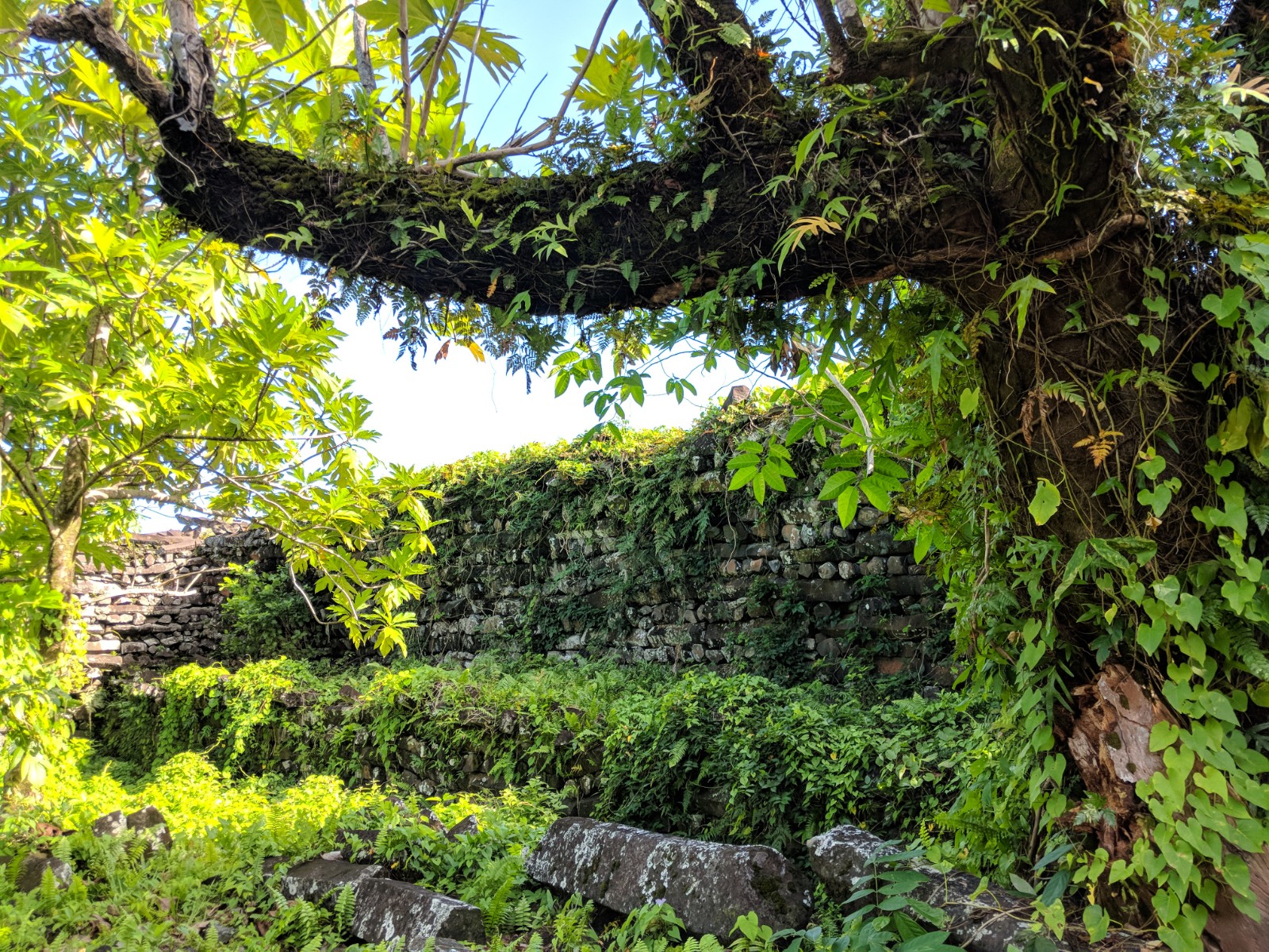
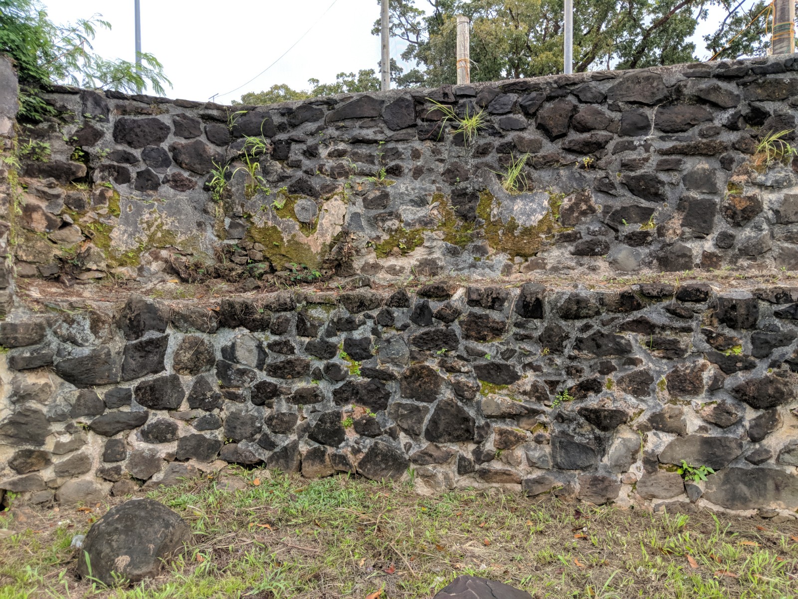
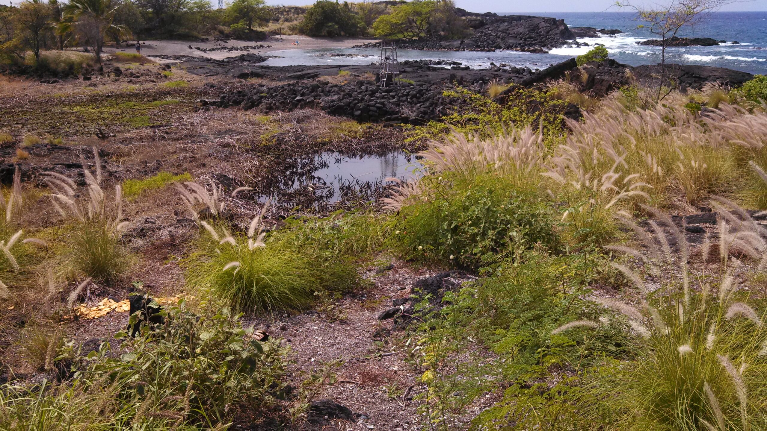
Both single and complex fish traps were observed. Fish come in when the tide is up, then become trapped when the tide recedes. Turtles also swim in, to rest and sun on the rocks. Wonderful ancient village sites, such as the one at Lapakahi, are still being restored and interpreted. It is comprised of ancient dwelling sites, fishing and salt procurement activities, and Kahuna training. The queen even visited here in the 19th C. The large stone basins, used for salt collection, grinding, and other needs, are readily visible to visitors. Stacked rock walls, showing the shape of old building shapes, are still visible in many areas of the Big Island. This site is on a rise, above a long established fishing area. Red dirt and botanical species were used extensively in old Hawaii, for everything from tea to poultices. An interpretive area near Keauhou Bay is signed for visitors to enjoy and better understand old Hawaiian uses of nature.
Field work is continuing on properties in the Willamette Valley and the Portland Basin. A huge thanks to the landowners for allowing us to inspect their ancient landscapes. First fieldwork there, then transported to a classroom for lunch and lectures in air-conditioned luxury.
Visitors can stroll the grounds of the museum, which have plants clearly identified, and also visit their science building.
The exhibits included some newly shared information about trans-oceanic people. The interpretive map of Banaba (below) shows how people may have known about other islands that were far away. A resource like this island would have been an incredible place for distant human populations to come into contact with each other.
In historic times, people traveled to Banaba to obtain the bird guano for fertilizer. In prehistoric times, seafaring people would have followed specific bird species, knowing that they were going to land after a certain distance.
The serrated surface of the island of Banaba-the result of 80 years of mining. Photo credit: Janice Cantieri
The museum’s exhibit illustrating the frame construction of thatched dwellings was informative. These structures had to be anchored when constructed on lava, such as on the Big Island.
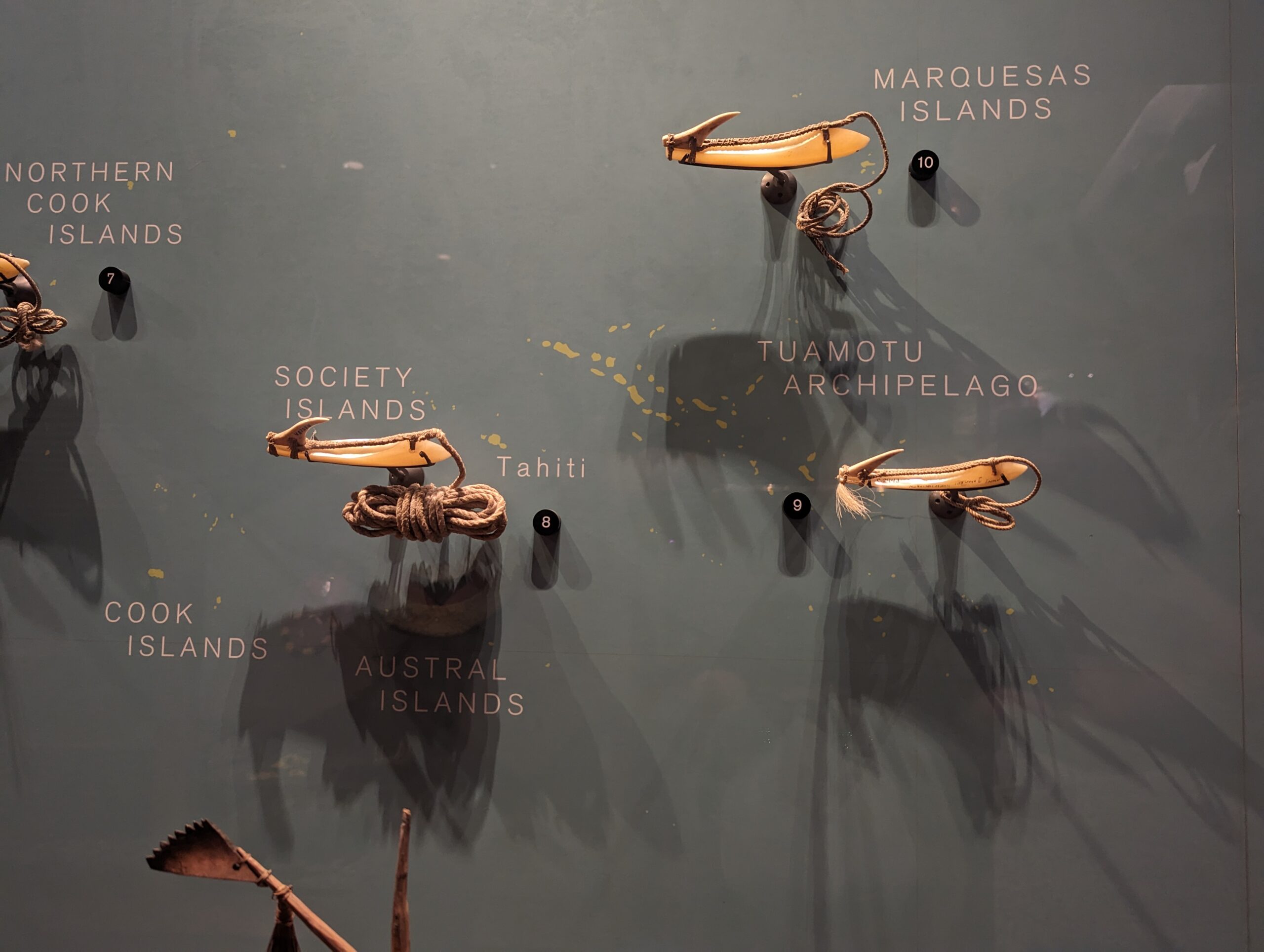
The display of fishhooks was especially important, as Pacific island sites are often dated and culturally associated by the fishhooks and other tools recovered from archaeological sites.
After hiking a few historic areas on Oahu, it was time to wave goodbye to Oahu turtles and go on to Rarotonga.
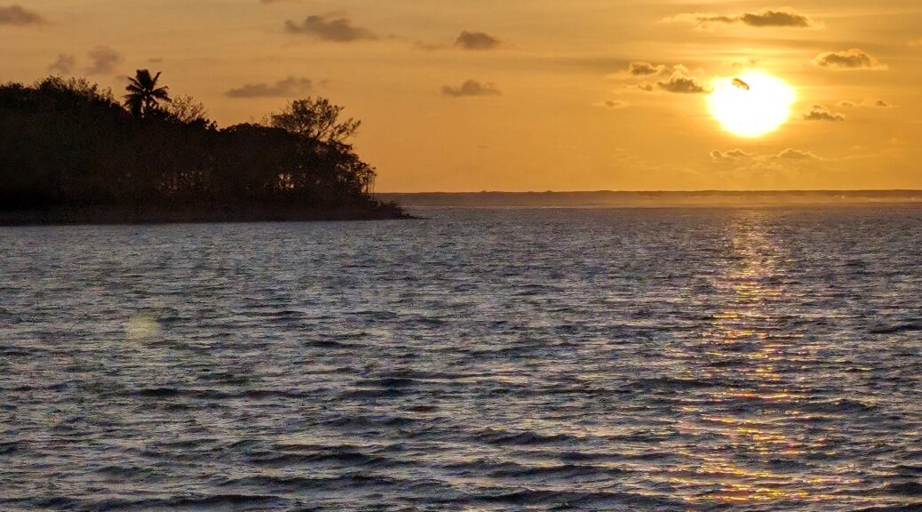
Aloha from a turtle in Oahu.A lovely sunset on Rarotonga. A wonderful welcome by people on the Cook Islands started this part of the journey off just perfectly.
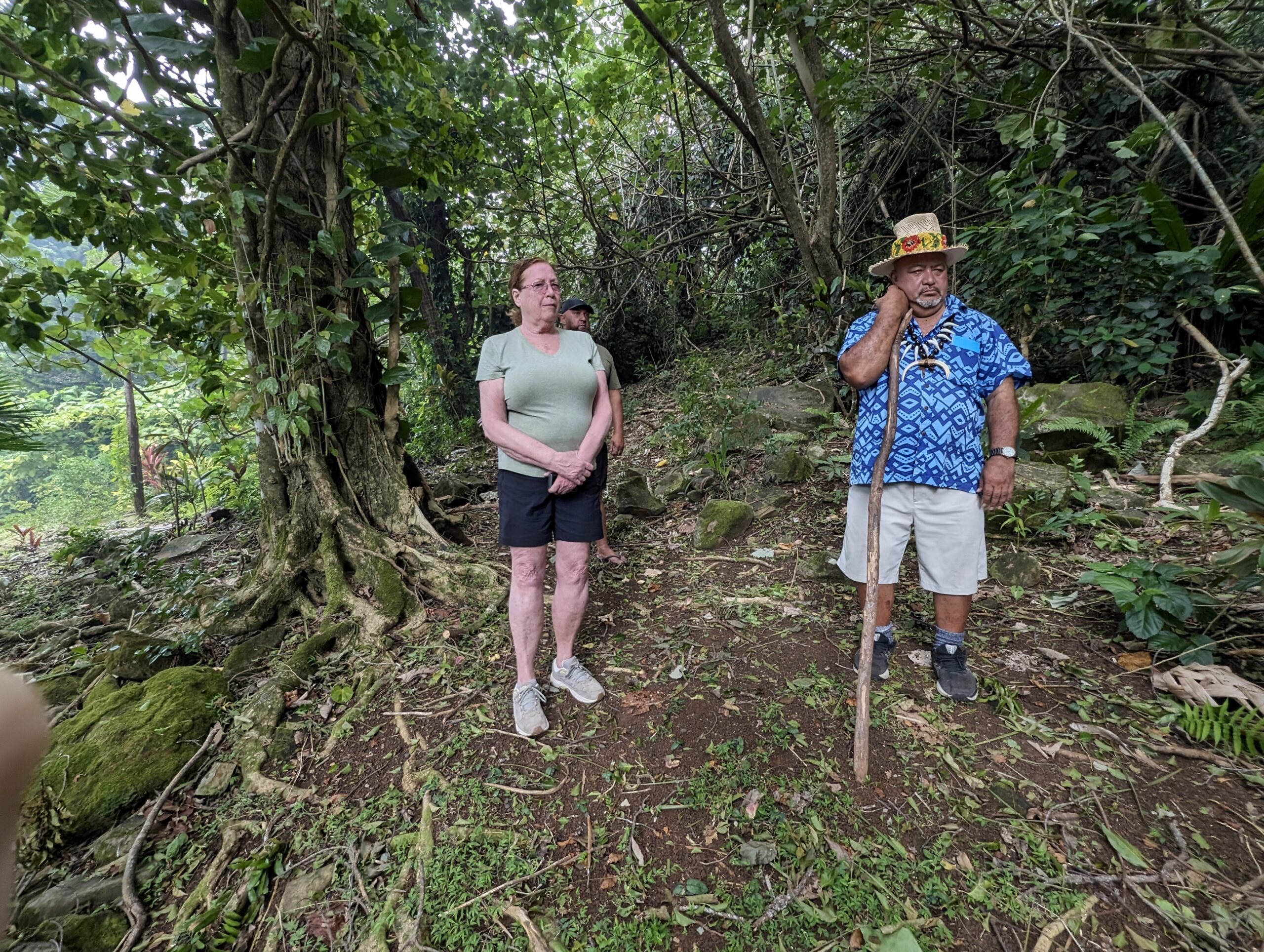
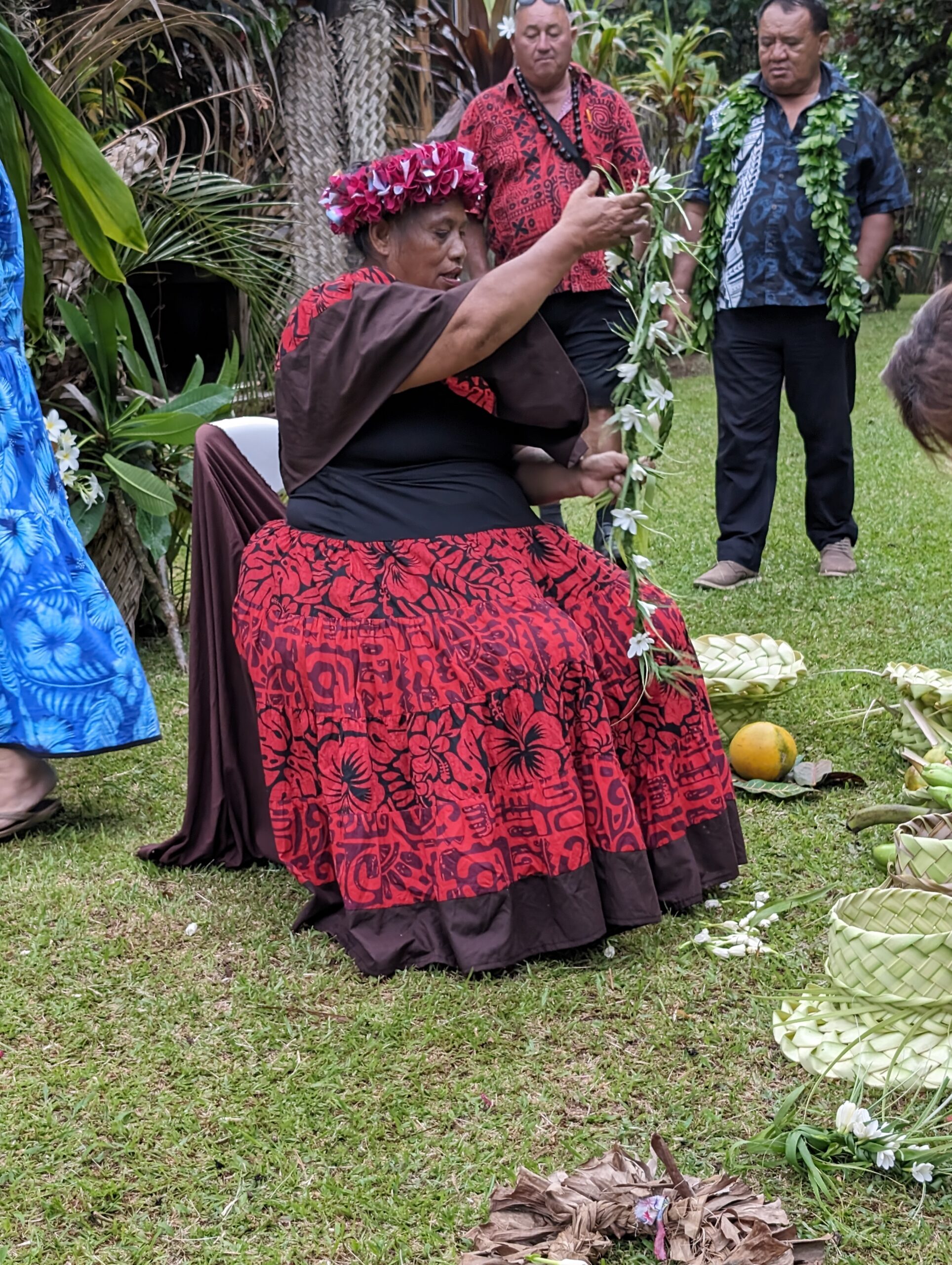
On Rarotonga, we chartered a tour with Raro Safari Tours. Our contact there, Tea, made sure that everything would be perfect. A personalized tour of archaeological and cultural sites was even better than expected, with a cultural spokesman, an actual chief, an island holy person, and a sociolinguist and ethnologist, all of whom shared much information about sites.
A personalized tour was so important, in finding sites but also learning about them from island notables.
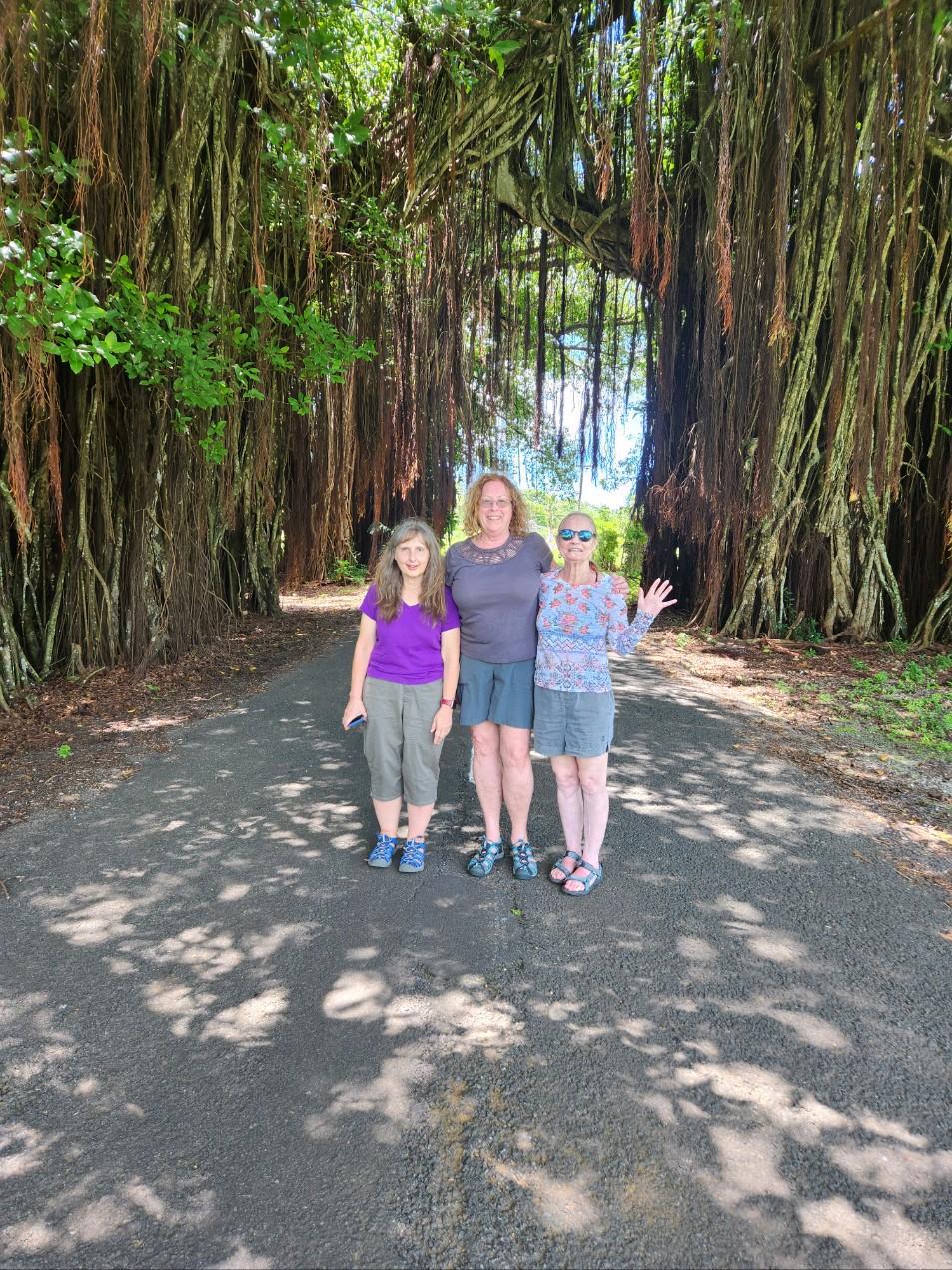
We were free to explore the beauty of the island, and enjoy some interpretive areas developed just for people to wander and enjoy.The people shown above (and those behind the scenes) include Makiuti Tongiia, Samuel Crocombe, and Sam. Also, Tutu (from Highland paradise) invited everyone to her cultural show. Chief Danny presided over our journey, making the tour perfect.
We then traveled to Aitutaki, for snorkeling and information from islanders about important areas and activities there.
The testing of a previously uninspected area of private land occurred in July of 2021. Local residents had reported finding several species of extinct animals nearby, including the giant ground sloth (Paramylodon harlani) and the mastodon (Mammut pacificus). To understand the environment in which these animals lived, small portions of the ancient sediments were recovered from underground for examination. Through our work in July, we were able to reconstruct the 14,000 year old ecozone for this specific area. This exciting field opportunity provided a location for people to learn or improve their skills in the methods of inspection and documentation that are appropriate to many Willamette Valley site areas. It also provided an opportunity to develop new partnerships with multiple organizations.
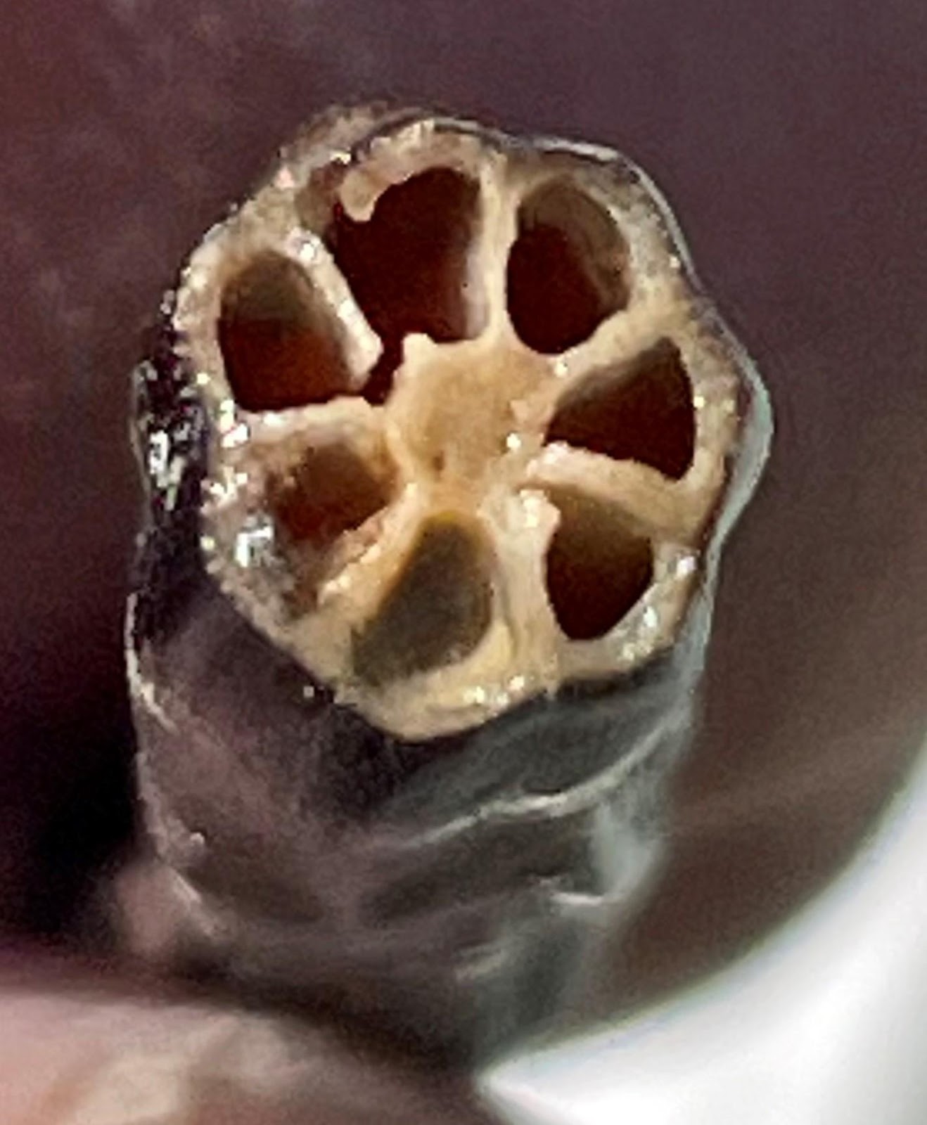
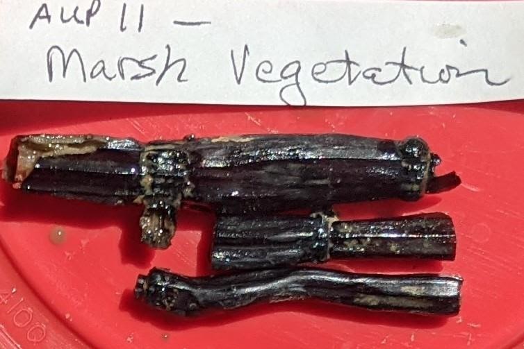
Four teams worked independently to remove soil samples and then to document them.Munsell color charts were consulted to accurately describe the colors of the sediments.Equisetum (horsetail fern) in cross-section (L). In several locations, short lengths of marsh plants were excavated (R).
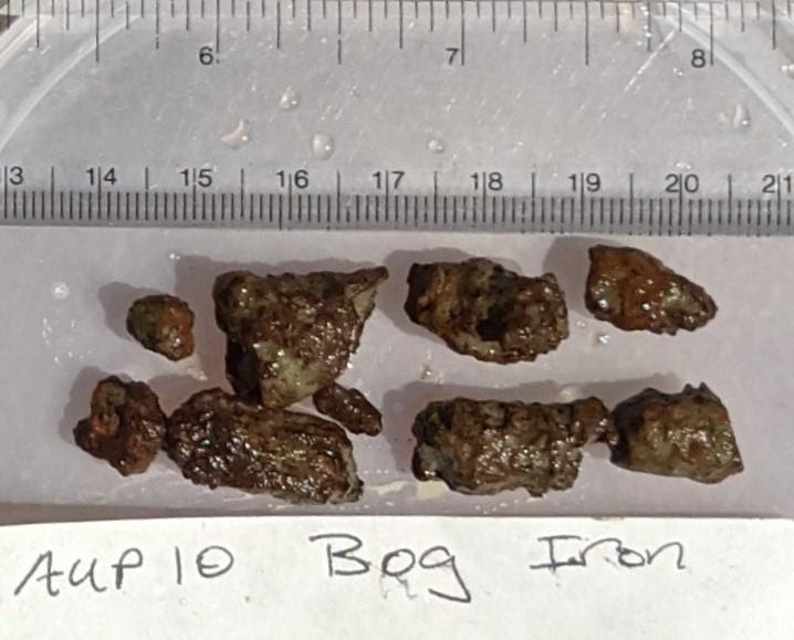
Bog iron was recovered from several auger probes and depths. The specimens collected during this project were 175-198 cms DBS (depth below surface).
Two samples from AUP 12 were radiocarbon dated. The first had remnants of bog and the second was a flood silt deposit lacking micaceous inclusions.
Two field opportunities again occurred in the summer of 2019, with one event in early July and the other in August. Two different site areas within the boundaries of the City of Woodburn were investigated. Parts of both had been previously tested, with positive results from those excavations. Included in previous finds were the giant bison (Bison antiquus), giant ground sloth (Paramylodon harlani), western horse (Equus occidentalis), and western camel (Camelops hesternus), all of which are now extinct. Some predator species in the area include the Pleistocene bear that became the black bear (Ursus americanus), dire wolf (Canis dirus), and a huge predator bird with a 12’-14’ wingspan (Teratornis woodburnensis). Also in this area are the remains of more typical species, including rabbit, muskrat, beaver, gopher, turtle, snake, deer, elk, coyote, and five other species of bird.
Recoveries this year were even higher than predicted. Ancient horse, approximately 3 years old, and elk were the dominant species at one site (L). At both sites, volunteers were still smiling, even on the last day (R). The different colors of soil represent different time periods, so even when they are mixed, the approximate age of a specimen is immediately known.Prior to examination of the excavated materials, each stratum (layer of soil) is documented. The depth of each stratum, the order in which each appears, and other observations are noted. The Woodburn area presents a perfectly preserved time capsule of the past 15,000 years. The characteristics of each stratum are reflected in this chart. The approximate depth below surface, order of each layer, individual characteristics, age, and previously documented contents are noted.
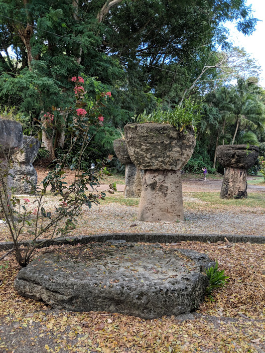
Guam has a Chamorro Village, as well as a park to feature some of the island’s Latte Stones. Both are accessible to visitors.This is an expansion of our previous travel archaeology classes, shifting our attention far eastward from the Hawaiian Islands. The focus of this project was to visit archaeological sites on both Guam and the island of Pohnpei, in the Pacific. Vast differences exist between these two islands, both culturally and archaeologically. Interestingly, each island supports large prehistoric stone features that are unique, and that are still being investigated today.
Guam has a Chamorro Village, as well as a park to feature some of the island’s Latte Stones. Both are accessible to visitors.
Japanese Caves from their occupation of Guam in World War II are also preserved. These caves are documented as having stored ammunition. Some caves, however, housed Japanese soldiers until 28 years after the end of World War II.
The remains of a Spanish Fort can be explored, with only occasional groups of school children sharing the site area. The Fort is accessed from the road that circles around Guam.
A prehistoric use area has continued into modern times, with people still enjoying the sheltered water here.
This onboard flight map illustrates the distance from North America’s west coast to Hawaii, and from Hawaii to Guam. Pohnpei, part of the Federated States of Micronesia, is partially obscured by the image of the airplane.
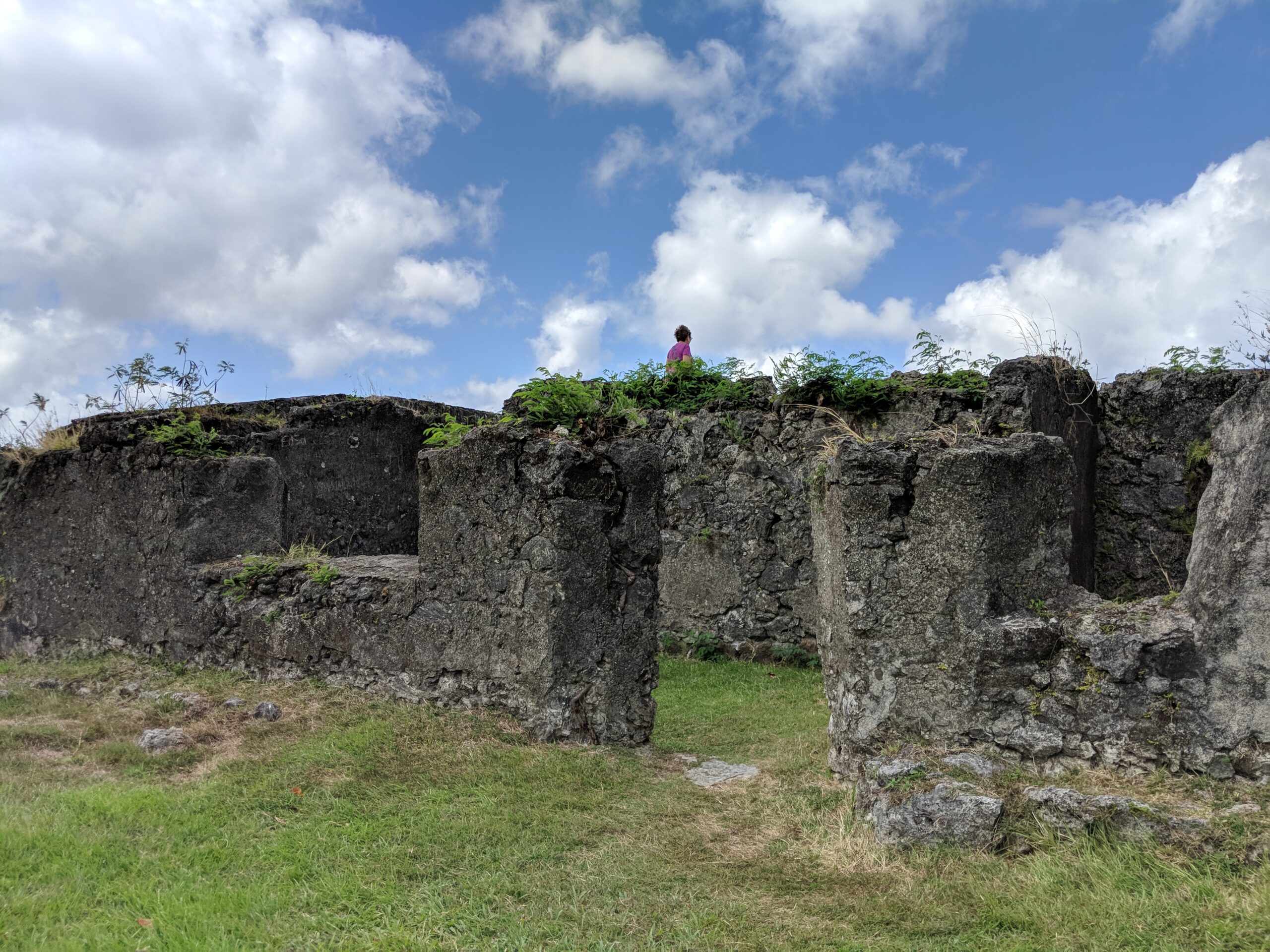
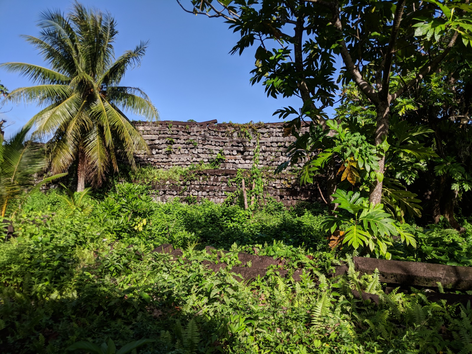
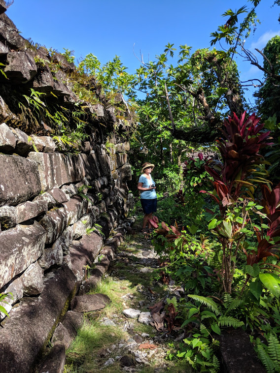
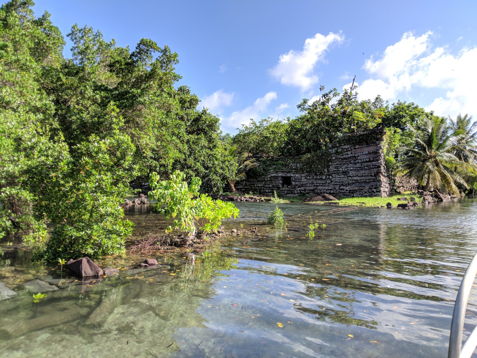
The ruins at Nan Madol make up a stunning archaeological complex. The site is composed of up to 98 man-made islets, separated by canals, which were also developed by ancient people. The structures are made primarily of columnar basalt.
The walls of the structures are of varying heights, with this being one of the lower portions. The beauty and strength reflected at this site complex are stunning, and impressive. Access can be by boat at high tide, or by walking. To take the trail, first check with the Chief and pay the entrance fee. This will be the entrance from Temwen Island. Impressive lengths of columnar basalt are stacked like a Lincoln log structure, forming enormous outer walls, as well as inner walled chambers. How the movement and onsite manipulation of these basalt columns was managed is still a question to be answered. Within the town of Kolonia, an early historic Spanish Wall is now part of a Park. Visitors are welcome to explore all around it. Kapingamarangi is actually an atoll, and a municipality, within the state of Pohnpei. While the atoll has a population of approximately 500 people, as many as 300 have moved to the city of Kolonia, on Pohnpei. There, they have created a woodworker’s village, although many hand crafted items of other materials are also produced.
Please contact I.A.S., through this website, for information on the next travel archaeology class.
There is a fascinating site area 30 miles south of Portland. It is ancient, far more than 10,000 years old. Contained within it is amazing evidence of times’ past. This resource is a record of the occupants of the Willamette Valley, from 15,500 to 10,500. It is also a record of dramatic environmental change. Thought provoking is an understatement!
Many giant animals, termed megafauna, lived at Woodburn during the last Ice Age. The remains of these four species have been documented at this site.
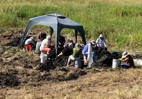
In July and in August, a limited number of Oregon Archaeology Society members will join IAS staff, in an opportunity to trowel through the soils of two known paleontological sites. From July 10-15, and from August 14-20, we will be exploring two different site areas. Both sites are in a locale known to contain numerous extinct, huge animals (figure 1). These include the giant bison (Bison antiquus), giant ground sloth (Paramylodon harlani), western horse (Equus occidentalis), and western camel (Camelops hesternus). Some predator species in the area include the Pleistocene bear that became the black bear (Ursus americanus), dire wolf (Canis dirus), coyote (Canislatrans), and a huge predator bird with a 12’-14’ wingspan (Teratornis woodburnensis). Also at this site are the remains of extant species, including rabbit, muskrat, beaver, gopher, turtle, snake, deer, elk, and five other species of bird.
Microscopic inspection of wood (L) helps to identify species, and the magnification of seeds (R) helps to speciate and to look for gnawing marks. Cherry seed photo provided by David Ellingson.
While the recovery of animal bone, mammalian hair, and the occasional lost cultural item are not frequent, nearly everyone recovers something. After troweling through blocks of ancient soils, volunteers water screen the sediments. This allows us to find specimens that were previously hidden within clumps of soil. Some recovered items are then examined microscopically, helping us to better identify each object (figure 2).
The different layers, or strata, reflect the many different ecosystems that have existed here over the last 16 millennia. Clearly seen are an ancient forest, stratified peat bogs, loamy soil interludes, and flood silts. Every year, volunteers are stunned by the dramatic changes that have occurred within a single place on the landscape, and by the preservation of even small seeds and ancient leaves.
Every stratum, or layer of soil, has a different color and consistency, which can be easily recognized.
Every stratum, or layer of soil, has a different color and consistency, which can be easily recognized (figure 3). The characteristics of each stratum have been documented, and each stratum has been dated. Thus, when volunteers excavate the blocks of sediments, the approximate age of recovered specimens is immediately known by the stratum from which items emerge. Beyond the actual recovery, it is simply exciting to be examining the soils as they existed more than 11,500 years ago.
OAS members won’t have to travel far from home, as we will again be at Woodburn. If you are interested in being one of the 8-10 OAS volunteers, please contact Alison Stenger, of the Institute for Archaeological Studies. Email alisonstenger@comcast.net, or call 503-292-5862. Be sure to check the Institute for Archaeological Studies website for a list of what to bring, and also to see pictures of past projects. This is a wonderful opportunity to learn archaeological methods while investigating a paleontological site. All tools, training, and laboratory supplies will be provided, but please bring a pair of clean kitchen (rubber) gloves. There is no fee, although a voluntary $20.00 donation is appreciated, to help offset expenses.
Start dates for newcomers will be a day later than for people with experience at these sites. Thus, those new to the Woodburn projects will start July 11 or August 15. This will give experienced personnel an opportunity to get the area prepared and ready for new volunteers. Those previously involved should, if possible, plan to help with site preparation on July 10 or August 14.
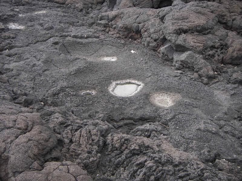
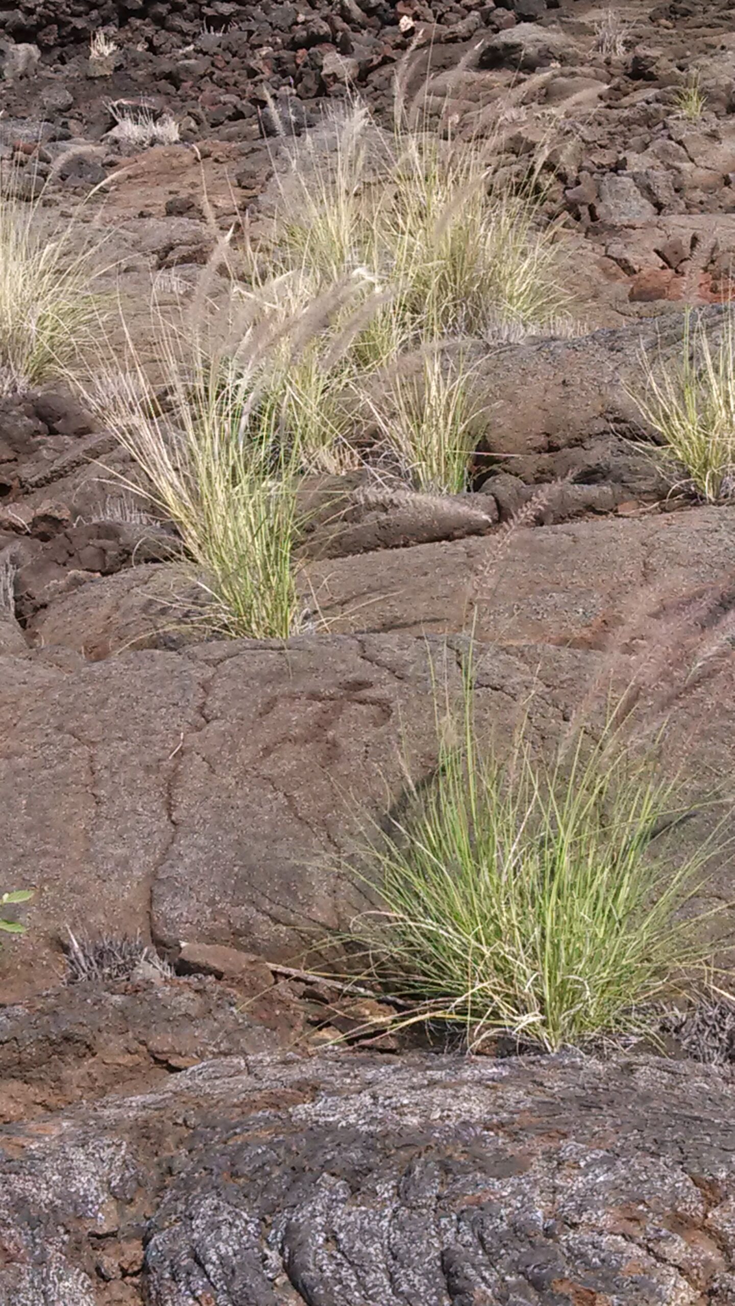
Hawaii is known to have cultural sites from the shoreline to the mountain peaks. These include ancient village remains, ceremonial structures, water catchment areas, petroglyphs, and fish traps. But many resources along the shoreline are not yet recorded, and this is especially true of petroglyphs and other rock features.
Many sites near the ocean provide some sort of catchment. Sometimes salt is desired, and sometimes fish or turtles are the focus. Water is often trapped in depressions for salt, or in stacked rock enclosures for marine animals.
These cultural features need to be located by GPS, and documented by photographs. Because many of these cultural resources are fragile, they need to be identified without putting them at risk. A professional archaeologist will lead this group effort, and also provide information about inland sites. Oregon Archaeological Society members, with their training and sensitivity to archaeological sites, are the perfect project volunteers for this project. The results of all shoreline documentation will be given to the Department of Land and Natural Resources, and to the State Historic Preservation Office.
Shoreline resources include ceremonial sites, aquaculture ponds, and canoe access areas.
Participants will be introduced to a variety of archaeological sites, when not documenting shoreline observations. We plan to visit a partially reconstructed village, aquaculture sites with three different types of aquatic environments, ceremonial sites, and at least one historic site.
Shoreline resources include ceremonial sites, aquaculture ponds, and canoe access areas.
This adventure in Hawaii will occur February 16-21, 2017, and is offered through the Institute for Archaeological Studies. For travel details, please contact Deanna Levinson of World Travel, dea@wtpdx.com , or phone 971-404-0338. The estimated cost for shared hotel, rental car, and airfare is $1,825.00. Travel miles may be used to offset the cost of the flight.
The Woodburn paleoarchaeological project began in 1995. Even today, the intent of our work is to investigate paleontological sites from an archaeological perspective. In other words, we are exploring ancient plant and animal sites, while employing the methods that need to be used in sites containing archaeological material.
Figure 1 (Right): OAS members working at a real paleontological site, honing their skill sets, and still having fun.
Happily, some of these areas do have it all, from plants and animals to naturally shed human hair. But there is another wonderful aspect to these projects. It is almost impossible to hurt anything. Whether volunteers are working on troweling techniques or documentation skills, these field opportunities provide a great environment in which to do this, and people manage to have fun in the process (Figure 1). When we excavate sites such as these, which are contained far below the surface, we bring in commercial excavating equipment.
Figure 2 (Above): Each stratum has a distinct color, texture, and age. Any specimen removed from one of these layers can thus be assigned an approximate date.
Figure 3. After troweling, sediments are processed with water (Left). This allows us to recover very small specimens (Right). The bone shown here is the partial mandible to a very small 12,000 year old minnow, about 1” (2.54 cm) in length. Fish photo provided by Joe Cantrell.
This makes our field time much easier and safer. The more recent soils are mechanically stripped off and placed to one side. The older sediments are then removed, and placed apart from the recent layers. Then, before we begin inspecting the older deposits, the newer material is looked at and then put back in the trenches. This makes the trench area much more stable.
Figure 4 (Left): Each independent layer of soil has its own characteristics, from color and texture to age.
Our focus is upon the late Pleistocene (Ice Age) to the early Holocene (modern epoch) sediments and their contents. The job of volunteers is to trowel through the soils, looking primarily for ancient animals and hints of a human presence. Each soil type has its own color, texture, age, and depositional history. Thus, people know something about these distinct strata when they first start troweling (Figure 2). Because we have already documented the age of each stratum, or layer, we know the approximate date for anything that is uncovered, based upon the sediments from which the item emerges.
Once the soils are inspected initially, they are moved to the water screening table for further investigation (Figure 3). This is where our recovery of microfauna (tiny bones) increases tremendously. Thanks to the North American Research Group (NARG), specialized screening stations have been developed to aid in our recovery of these very small specimens. New OAS volunteers, working with NARG and other experienced field people, learn about water screening, as well as about minerals and other interesting parts of the natural world—what we oldies call natural history, of course.
The sites in Woodburn are particularly compelling. With their consistent stratigraphic sequences (layering of sediments), the depositional history of the last 16,000 years is available for us to inspect (Figure 4). The environment that changed so significantly over time, from bog to forest, is clearly portrayed. Because of this, we are often joined by other archaeologists, geologists, paleontologists, and botanists. Specialists from natural history museums, and from some tribal groups, also venture here when we are working, and they often share their expertise with us. This gets especially interesting, when we journey with them to one of the specimen repositories and see what else has emerged from the sediments during our years of working here (Figure 5).
Figure 5 (Right): Specialists from many disciplines, including some tribal groups, share their expertise with us. This is true in the field and during lunch breaks, making our days at work very special.
To date, we have recovered the remains of over a dozen species of extinct Ice Age fauna (animals), as well as the remains of animal species that still exist today. The animals range in size from huge to tiny! The list includes giant bison, Pleistocene bear, mammoth, mastodon, ancient species of horse and camel, dire wolf, and giant ground sloth. Deer and elk, of the type that exist to this day, are also represented in the Ice Age deposits, along with coyote. Sometimes we see the animals represented by their skeletal remains, and sometimes by their teeth. A lot of bird material is also evidenced, from extant species of ducks and geese to a giant predator bird called a teratorn that is long extinct. We also have mink, muskrat, squirrels, gopher, turtle, fish, frog, rattlesnake, and snails represented. Occasionally, too, we see flaked stone or cut animal bone, and naturally shed hair. Some of the hair is human, and some is from animals. There is never very much, but it is enough to keep us investigating. The sediment layers change dramatically and quickly, over the fifteen hundred years that represent the ending of the Pleistocene. From the time before the very last Missoula Flood affected the Valley, just over 12,300 years ago, until the Pleistocene’s end at 10,800 years ago, we see four stunning changes in the environment. Then, after the ending of the Ice Age, we see another three very different ecosystems represented. Thus, in total, our volunteers experience seven different ecologies. Their job for much of the project is to focus upon the oldest four. One of the many fascinating things about this long term project is that the presence of Pleistocene animals and Ice Age humans terminates with the transition into the Holocene. At 10,800 years ago, these valley inhabitants completely drop out of the stratigraphic record. The early post-Ice Age here is archaeologically and paleontologically sterile. From our field work, we know that preservation is not the cause of this sudden absence of these population groups. The early Holocene sediments reflect the same neutral pH level as the layers from over 11,000 years ago. Therefore, as wood and teeth from the Pleistocene are remarkably well preserved (Figure 6), the same level of preservation should be reflected in the more recent sediments. This expectation is clearly supported by the early Holocene botanical materials that are excavated. But, animals and any evidence of a human presence have disappeared.
Figure 6. Even after being left out in the sun for a week, wood is still remarkably preserved (Right). Teeth, too, come out of the Pleistocene sediments in an excellent state of preservation (Left).
What happened to cause this change, leaving the valley floor remarkably barren? That question is part of what keeps us coming back.
The Nottoway River Survey announces the publication of Nottoway River Survey, Part-II, Cactus Hill and Other Excavated Sites. The focus of the book is pre-Clovis, Paleoindian, and Archaic period research in a 400-square-mile area of southeastern Virginia in the mid-Atlantic region of eastern North America.
While the work contains a general summary of over 30 years of research on more than 80 Native American sites within the Nottoway River drainage, the specific emphasis is upon new data including radiocarbon dates and other multidisciplinary findings from the NRS excavations in the pre-Clovis and Clovis cultural levels on the well known Cactus Hill archaeological site.
Nine years in writing, this very attractive book printed in the US by Dietz Press as a limited edition contains 715 8-1/2″ x 11″ pages in glossy paper with a wear resistant soft cover and sewn binding construction suitable for use in classroom, office, and laboratory environments. There are 12 chapters consisting of an introduction, a summary, a NRS pre-Clovis and Paleoindian 22-year-research-update chapter covering the period since the publication of Part-I, and nine separate site excavation chapters centering around the 210-page (Chapter 5) Cactus Hill site final report.
The book contains 105 data tables and 310 black and white figures with over 590 individual photographs, drawings, and graphs of archaeological excavations, artifacts, artifact sequences, in situ excavation features, excavation layouts, cultural material and scientific sample depth relationships, and general site area and river scenes. This work represents one of the first attempts to evaluate the various early point traditions based upon the use of specific site-water-related environments or microenvironments, site topography, and band range or territory size.
The book is recommended for those involved in research, teaching, or CRM work in the East. It will also be of significant value to anyone interested specifically in North American pre-Clovis and Paleoindian topics.
The cost is $79.50 per copy plus a shipping and handling cost of $8.00 per book; we ship by USPS (book rate) in sturdy cardboard containers, and we ship only within the US. Included with each Part-II book ordered will be a complimentary copy of Nottoway River Survey, Part-I, Clovis Settlement Patterns, the popular 171-page work that was published in 1992, which normally sells for $22.00. The total shipment weight per book order is 6.5 pounds.
For shipment within the US, please send check or money order totaling $87.50 per book (Virginia residents please add 5.3% sales tax on $79.50) to:
Nottoway River Publications 5861 White Oak Road Sandston, Virginia 23150